Atmospheric Dispersion
The dispersion team focuses on the quantification of radioactive pollutant dispersion through the atmosphere or water bodies and evaluate associated consequences or risks. The spatial scale varies from the urban scale of a few tens of kilometres to long range of over 2000 kilometres. Our purpose is to build local capabilities capable of providing reliable and dependable insights of radioactive pollutants pathways in the environment for decision-makers and stakeholders. We also aim to establish recognition and reputation in the scientific community.
The team mainly utilise numerical models to help us better understand physical processes of the transport, dispersion, and deposition of radioactive pollutants under various environmental conditions and source release scenarios in our region. Most of these models are commonly used community ones such as the ARGOS, MACCS (MELCOR Accident Consequence Code System), HYSPLIT (Hybrid Single Particle Lagrangian Integrated Trajectory Model), and FLEXPART (FLEXible PARTicle dispersion model). We also develop our own dispersion models to adopt refined grid mesh and to incorporate high-resolution local data which can be challenging for community models. These data include local weather observations, GIS information, and population density etc., which are critical for addressing urban scale dispersion problems.
For the source release, our team work closely with the severe accident simulation team for obtaining source terms from their simulations or analyses. Hypothetical sources are also frequently used in our studies. The environmental data that we have been using include local meteorological observations from NEA (National Environment Agency), gridded meteorological data from NCEP (National Centers for Environmental Prediction), ECMWF (European Centre for Medium-Range Weather Forecasts) or running regional model WRF (Weather Research and Forecasting model), and ocean current data from NASA (National Aeronautics and Space Administration).
The following results are from SNRSI’s latest research on radioactive pollutant dispersion problems on both long-range and urban scales.

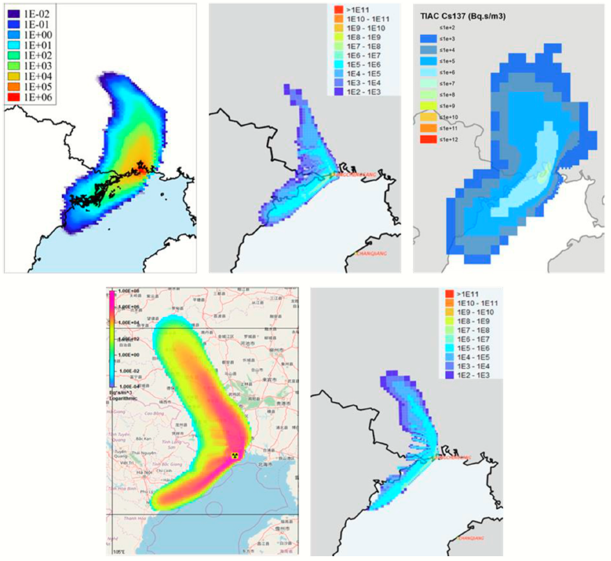
Benchmarking atmospheric dispersion models via simulations of a hypothetical release of Cs-137 with a total amount of 6x10¹³ Bq at constant rate for one day at Fangchenggang, China. The models on top row from left to right are FLEXPART, JRodos (LASAT), and PAGE respectively; on the bottom are ARGOS and JRodos (Rimpuff). (Silva et al. 2021)


Population density (left panel [km-2]) and the median 10-day peak dose (right panel [mSv]) after a hypothetical accident with a total release of 4.38x10¹² Bq from a light water small modular reactor at Changi. (Chai et al. 2023)


Sensitivity study of dispersion simulation to different quality of meteorological data (due to assimilation frequency of observations as shown on left panel) of GFSr, GFSm, ERA5. The right panel shows the particle horizontal distribution (black) and vertical extension projected from two directions (red from south, blue from west) on day seven with hypothetical constant release of Cs-137 at the rate of 7x10¹³ Bq/h from Singapore. (Sun et al. 2023)
In part to develop regional expertise and tap on knowledge in the region, the team is an active member in the ASEAN Network on Nuclear Power Safety Research (ASEAN NPSR). 9 member states have participated in this network including Cambodia, Indonesia, Laos, Malaysia, Myanmar, the Philippines, Singapore, Thailand, and Vietnam. The ASEAN NPSR organises annual meetings where the representatives from the respective countries share their findings on the collaborative research with other members in the network.

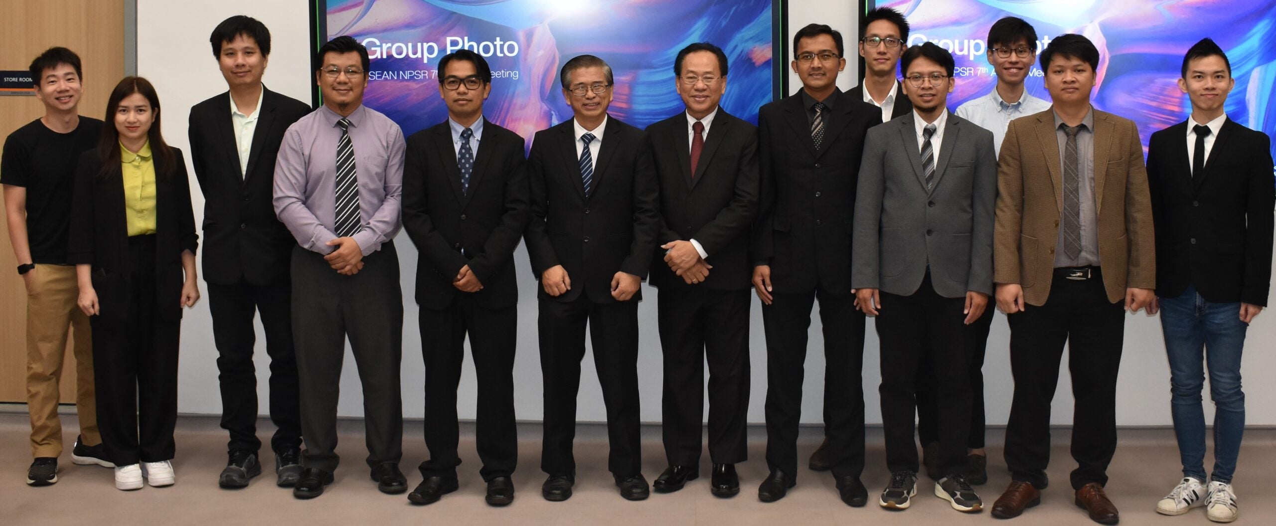
ASEAN Network on Nuclear Power Safety Research meeting held at Singapore, 2024.
Left to right: Ian Ang, Ho Kieu Chinh, Weerawat Pornroongruengchok, Mohamad Hairie Rabir, Phongsakorn Prak Tom, Chung Keng Yeow, Jupiter Sitorus Pane, Haryo Seno, Guo Zhexi, Anis Rohanda, Anders Choo, Pham Kim Long, Adolphus Lye.

